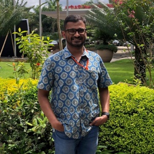
Sumin George is senior programme coordinator at the Keystone Foundation, India, working on the REDAA-supported initiative “Community-based ecological restoration of degraded grasslands, dry and wet forests in partnership with Indigenous People of the Nilgiri Biosphere Reserve, Western Ghats: a global biodiversity hotspot in India"
Your project is supporting local communities with scientific assessment tools to map invasive species and help replace them with native ones. What’s the issue with invasive species?
Sumin: Invasive species are one of the major causes of degradation in the Western Ghats in India. Over the years, due to the lack of proper land management, invasive species have taken over a significant portion of forests and grasslands and created problems for wildlife - reducing the regeneration of native species and forage for wild animals.
Indigenous Peoples who depend on these landscapes for food and culture have also been affected.
So, what’s your project aiming to achieve?
This project aims to establish pilot models for restoration, using small areas to see how the pilot works best in a specific context.
In terms of mapping, we want to understand the composition of the native forest or whatever remains. Local people have a very close relationship with forests, and they are very aware of which species are found where. To confirm that, and to serve as a basis for restoration, we are using certain tools like a digital app called an Open Data Kit.
What’s that about?
Sumin: It’s like Google Forms – a digital form. It has data collection fields where people can just record what they see with their smartphone. The information is transferred to the main server, and we get an assessment of the composition of the forest.
There’s another app, which is exclusively for invasive species. It describes the species identified - maybe even including a pictorial representation. There are fixed ways where people can walk in a transect or take certain grids in their area and mark where all these invasives are found.
So, that give us a spread of which invasive species are dominant.
What are the typical invasive species? And how have they got there?
Sumin: We have close to 200 invasive species and the apps we use monitor at least 85 of them. These could be herbs, shrubs, also trees for that matter.
A very prominent one is Lantana Camera. Garden nurseries promoted it because it has beautiful flowers.
And then there are plants from the Senna and Cestrum species. They form thick ground cover and stop sunlight getting to the soil – Senna is toxic, in fact, and causes the soil to deteriorate.
Removing these species is a very tedious process. You need special equipment, including gloves and a mask, because removing them with bare hands would cause discomfort. And Senna and Cestrum are not palatable at all. At least bears and birds feed on Lantana seeds - though that encourages the natural dispersal of lantanas.
You’ve talked about combining traditional knowledge with science – how does that work? What do you take from each area?
Sumin: We do something called barefoot ecology. It means training Indigenous communities how to collect data, as I mentioned earlier: how to walk a transect or how to make consistent observations. So, they can still make the observations in their own language but in a more organised way.
A lot of people retain this information in their memory so they know how seasons change and how species have also changed. Our approach is more systematic and there's a record of events that happen over time.
What kind of landscape are you working in?
Sumin: Two of the locations we work on are up in the mountains at around 2,000 metres - the grassland and the high elevation forest systems – the shola forest. The shola forest is a complex of evergreen forest and grassland.
And we work in the scrub at the lower elevation. Scrub and dry deciduous – so bushes and dense trees in an area of low rainfall.
You also say you plant native species involving relevant stakeholders. What are the native species and what’s their purpose?
Sumin: Native species are those found in a forest that have not been degraded by invasive plants. It could be anything from herbs to trees. We look at the entire strata and the economic value these species provide to the communities in terms of the fruits or the bark that they would collect.
We also look at what they provide as habitats for bees and birds. And the medicinal values of the herbs that are found there, the forage potential for wild animals.
What kind of wild animals?
Sumin: There are elephants, tigers, the Indian Gaur or the Indian bison. But also the spotted deer, leopards, the Sambar deer, the spotted deer, the Barking deer, the mouse deer, the sloth bear.
And who are the relevant stakeholders of your project?
Sumin: Our key stakeholders are the Indigenous communities, the district government forest department and other forest dwellers who are not indigenous but settlers in the region – the local communities.
And research institutions that are keen to share information and expertise and are already practising ecological restoration.
What would you call success in the project?
Sumin: Setting up one pilot plot in each of these ecosystems and showing that ecological restoration is possible, that would be a success. Likewise, if the forest department, who own the land, although it also traditionally belongs to Indigenous communities, adopted the pilots, they could become a model for scaling up.
And more importantly, if all the stakeholders could participate equally, I think that would also be a very good measure of success.
